Choose your shipping method in Checkout. Costs may vary based on destination.
Seller's Description:
Book is in good condition and may include underlining highlighting and minimal wear. The book can also include From the library of labels. May not contain miscellaneous items toys dvds etc. We offer 100% money back guarantee and 24 7 customer service.
Choose your shipping method in Checkout. Costs may vary based on destination.
Seller's Description:
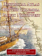
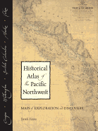
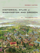
Very Good. Book is in very good + condition. Light edge wear. Interior pages are crisp and clean. Dust jacket has shelf wear, corner and edge wear/bumping. Approx 2 inch tear to back cover at bottom edge. Maps of exploration in British Columbia, Washington, Oregon, Alaska and the Yukon. 322 historical maps are reproduced, many in color. 208 pp. Index. Year 1999. Oversize/Overweight, No International shipping, No Expedited shipping. Standard shipping only.
Choose your shipping method in Checkout. Costs may vary based on destination.
Seller's Description:
Near Fine in Very Good dust jacket. 1552899004. DJ has short tear top of spine area, light creasing, light shelf wear.; A bright, solid book. Dust jacket in Mylar jacket protector. B&W and colour maps and illustrations throughout, typical of Derek Hayes' publications.; 6.11 X 1.11 X 11.11 inches; 208 pages; "Here is history from a geographical viewpoint! For the first time, many of the old maps of British Columbia and the Pacific Northwest have been gathered together in a single book, creating an atlas of antique maps that tell a continuing story of the expanding frontier of knowledge about the region. The Historical Atlas of British Columbia and the Pacific Northwest is a unique collection of over 320 original maps of explorers and navigators from four centuries of voyages and overland treks of exploration and discovery to the northwest coast, plus native maps, and a host of others selected for their interest or historical significance. There are imaginary and speculative maps, old political boundary maps, boundary dispute maps, military and spy maps, bird s eye maps, gold rush maps, railway maps and Hudson s Bay Company maps. All are reproductions of hand-drawn or contemporary engraved originals. The maps are combined with context-setting history, explanations of how the maps came to be drawn, and the history behind them. Here are the maps of Spanish, British, Russian, American, French and other explorers who literally put the Pacific Northwest on the map-Francis Drake, Vitus Bering and Alexei Chirikov, James Cook, Juan Francisco Bodega y Quadra, Alejandro Malaspina, Dionisio Galiano, George Vancouver, Alexander Mackenzie, Meriwether Lewis and William Clark, David Thompson, Charles Wilkes, John Charles Fremont, and many others. In drawing their maps, these explorers and mapmakers helped fill in geographical knowledge of one of the last remaining gaps in the map of the world. A unique and stunning new perspective on the history of British Columbia and the Pacific Northwest. The Historical Atlas of British Columbia and the Pacific Northwest contains high quality reproductions of 335 original maps, with over 235 covering the territory which is now British Columbia. Of the 335 old maps, 180 are in colour and 155 in (usually original) black and white; there are 60 other illustrations, including modern colour photographs and black and white historical photographs and engravings; 27 are in colour, 33 in black and white."
Choose your shipping method in Checkout. Costs may vary based on destination.
Seller's Description:
Very Good in Very Good jacket. pp. 208, "The Historical Atlas of British Columbia and the Pacific Northwest contains high quality reproductions of 335 original maps, with over 235 covering the territory which is now British Columbia. Of the 335 old maps, 180 are in colour and 155 in (usually original) black and white; there are 60 other illustrations, including modern… 4to.
Choose your shipping method in Checkout. Costs may vary based on destination.
Seller's Description:
Revised edition. Maps of exploration-British Columbia, Washington, Oregon, Alaska, Yukon. Map endpages. Folio 13" tall x 9 3/4". Red boards stamped in gilt on spine. 325 numbered high quality antique map illustrations-many in color. 208 pages printed on high quality paper. Dust jacket. Clean. Tightly bound. Fine/near Fine.
Choose your shipping method in Checkout. Costs may vary based on destination.
Seller's Description:
Near Fine in Very Good dust jacket. 1552899004. Signed by Author; DJ shows light shelf wear with short tear top of spine, light creasing.; Signed by the author on the title page. A bright, solid book, boards are in near-fine condition.; 13.0 X 10.0 X 1.3 inches; 208 pages; "Here is history from a geographical viewpoint! For the first time, many of the old maps of British Columbia and the Pacific Northwest have been gathered together in a single book, creating an atlas of antique maps that tell a continuing story of the expanding frontier of knowledge about the region. The Historical Atlas of British Columbia and the Pacific Northwest is a unique collection of over 320 original maps of explorers and navigators from four centuries of voyages and overland treks of exploration and discovery to the northwest coast, plus native maps, and a host of others selected for their interest or historical significance. There are imaginary and speculative maps, old political boundary maps, boundary dispute maps, military and spy maps, bird s eye maps, gold rush maps, railway maps and Hudson s Bay Company maps. All are reproductions of hand-drawn or contemporary engraved originals. The maps are combined with context-setting history, explanations of how the maps came to be drawn, and the history behind them. Here are the maps of Spanish, British, Russian, American, French and other explorers who literally put the Pacific Northwest on the map-Francis Drake, Vitus Bering and Alexei Chirikov, James Cook, Juan Francisco Bodega y Quadra, Alejandro Malaspina, Dionisio Galiano, George Vancouver, Alexander Mackenzie, Meriwether Lewis and William Clark, David Thompson, Charles Wilkes, John Charles Fremont, and many others. In drawing their maps, these explorers and mapmakers helped fill in geographical knowledge of one of the last remaining gaps in the map of the world. A unique and stunning new perspective on the history of British Columbia and the Pacific Northwest. The Historical Atlas of British Columbia and the Pacific Northwest contains high quality reproductions of 335 original maps, with over 235 covering the territory which is now British Columbia. Of the 335 old maps, 180 are in colour and 155 in (usually original) black and white; there are 60 other illustrations, including modern colour photographs and black and white historical photographs and engravings; 27 are in colour, 33 in black and white."
Choose your shipping method in Checkout. Costs may vary based on destination.
Seller's Description:
Fine in Fine dust jacket. 1552899004. 208 pages. Index. Footnotes. "A unique collection of over 320 original maps of explorers and navigators from four centuries of voyages and overland treks of exploration and discovery to the northwest coast, plus native maps, and a host of others selected for their interest and historical significance."-dust jacket. Clean, bright and unmarked with very light wear. An excellent example of this wonderful work.; Folio-over 12"-15" tall; BRITISH COLUMBIA_HISTORY CANADA_HISTORICAL GEOGRAPHY NORTHWEST Historical Atlas of British Columbia and the Pacific Northwest: Maps of Exploration-British Columbia, Washington, Oregon, Alaska and Yukon Cartography.