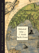
Map junkies rejoice! Derek Hayes, author of Historical Atlas of the Pacific Northwest, delivers another stunning atlas filled with stories of explorations and exquisite historical maps. Over five hundred years of maps depicting the North Pacific Ocean and the lands that border it -- the United States, Canada, Alaska, Russia, Japan, Korea, and China -- have been collected into this new atlas. From antique maps of the sixteenth century to modern satellite images, this volume covers all the major explorations, such as Magellan ...
Read More
Map junkies rejoice! Derek Hayes, author of Historical Atlas of the Pacific Northwest, delivers another stunning atlas filled with stories of explorations and exquisite historical maps. Over five hundred years of maps depicting the North Pacific Ocean and the lands that border it -- the United States, Canada, Alaska, Russia, Japan, Korea, and China -- have been collected into this new atlas. From antique maps of the sixteenth century to modern satellite images, this volume covers all the major explorations, such as Magellan, Bering, Cook, and Vancouver; Perry's opening of Japan; and the U.S. North Pacific Exploring Expedition. It also includes modern maps that use the latest technology to show ocean currents, fault lines, and the seabed in astounding detail.
Read Less
Choose your shipping method in Checkout. Costs may vary based on destination.
Seller's Description:
Very good. Connecting readers with great books since 1972! Used books may not include companion materials, and may have some shelf wear or limited writing. We ship orders daily and Customer Service is our top priority!
Choose your shipping method in Checkout. Costs may vary based on destination.
Seller's Description:
Fine in Fine jacket. Book. Folio-over 12-15" tall. Hardcover 2002 edition. Dust jacket and boards in fine condition. Binding firm. Pages unmarked and clean. (224 pages)
Choose your shipping method in Checkout. Costs may vary based on destination.
Seller's Description:
Near Fine in Very Good+ dust jacket. 1570613117. Light wear to dustjacket; A bright, solid book dustjacket in Mylar, unclipped.; B&W and Colour Illustrations; 13.3 X 10.3 X 0.9 inches; 224 pages; "Over five hundred years of maps depicting the North Pacific Ocean and the lands that border it-the United States, Canada, Alaska, Russia, Japan, Korea, and China have been collected into this new atlas. From antique maps of the sixteenth century to modern satellite images, this volume covers all the major explorations, such as Magellan, Bering, Cook, and Vancouver; Perry's opening of Japan; and the U.S. North Pacific Exploring Expedition. It also includes modern maps that use the latest technology to show ocean currents, fault lines, and the seabed in astounding detail."