12,000 years ago the area that now forms the southern North Sea was dry land: a vast plain populated by Mesolithic hunter-gatherers. By 5,500 BC the entire area had disappeared beneath the sea as a consequence of rising sea levels. Until now, this unique landscape remained hidden from view and almost entirely unknown. The North Sea Palaeolandscape Project, funded by the Aggregates Levy Sustainability Fund, have mapped 23,000 km2 of this "lost world" using seismic data collected for mineral exploration. "Mapping Doggerland" ...
Read More
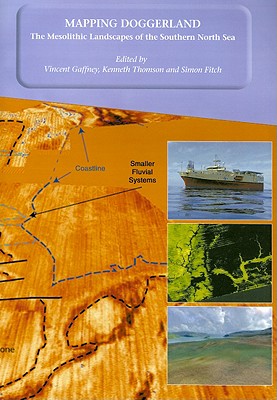
12,000 years ago the area that now forms the southern North Sea was dry land: a vast plain populated by Mesolithic hunter-gatherers. By 5,500 BC the entire area had disappeared beneath the sea as a consequence of rising sea levels. Until now, this unique landscape remained hidden from view and almost entirely unknown. The North Sea Palaeolandscape Project, funded by the Aggregates Levy Sustainability Fund, have mapped 23,000 km2 of this "lost world" using seismic data collected for mineral exploration. "Mapping Doggerland" demonstrates that the North Sea covers one of the largest and best preserved prehistoric landscapes in Europe. In mapping this exceptional landscape the project has begun to provide an insight into the historic impact of the last great phase of global warming experienced by modern man and to assess the significance of the massive loss of European land that occurred as a consequence of climate change.
Read Less
Choose your shipping method in Checkout. Costs may vary based on destination.
Seller's Description:
New. Trade paperback (US). Glued binding. 143 p. Contains: Illustrations, black & white, Illustrations, color, Line drawings, black & white, Line drawings, color, Tables, black & white, Maps, Figures.
Choose your shipping method in Checkout. Costs may vary based on destination.
Seller's Description:
PLEASE NOTE, WE DO NOT SHIP TO DENMARK. New Book. Shipped from UK in 4 to 14 days. Established seller since 2000. Please note we cannot offer an expedited shipping service from the UK.
Choose your shipping method in Checkout. Costs may vary based on destination.
Seller's Description:
New. Trade paperback (US). Glued binding. 143 p. Contains: Illustrations, black & white, Illustrations, color, Line drawings, black & white, Line drawings, color, Tables, black & white, Maps, Figures.
Choose your shipping method in Checkout. Costs may vary based on destination.
Seller's Description:
New. 2007. Paperback. Oxbow says: Mapping Doggerland documents the methodology and results of an innovative project to investigate a large area of the Southern North Sea, submerged during the last Glacial Maximum between 10, 000 and 7500 bp. Num Pages: 131 pages, col pls and figs, tbs. BIC Classification: 1QSF; HDDA; HDR. Category: (P) Professional & Vocational. Dimension: 298 x 209 x 11. Weight in Grams: 506......We ship daily from our Bookshop.
Choose your shipping method in Checkout. Costs may vary based on destination.
Seller's Description:
New. Trade paperback (US). Glued binding. 143 p. Contains: Illustrations, black & white, Illustrations, color, Line drawings, black & white, Line drawings, color, Tables, black & white, Maps, Figures. In Stock. 100% Money Back Guarantee. Brand New, Perfect Condition, allow 4-14 business days for standard shipping. To Alaska, Hawaii, U.S. protectorate, P.O. box, and APO/FPO addresses allow 4-28 business days for Standard shipping. No expedited shipping. All orders placed with expedited shipping will be cancelled. Over 3, 000, 000 happy customers.
Choose your shipping method in Checkout. Costs may vary based on destination.
Seller's Description:
Fine. Trade paperback (US). Glued binding. 143 p. Contains: Illustrations, black & white, Illustrations, color, Line drawings, black & white, Line drawings, color, Tables, black & white, Maps, Figures. In Stock. 100% Money Back Guarantee. Brand New, Perfect Condition, allow 4-14 business days for standard shipping. To Alaska, Hawaii, U.S. protectorate, P.O. box, and APO/FPO addresses allow 4-28 business days for Standard shipping. No expedited shipping. All orders placed with expedited shipping will be cancelled. Over 3, 000, 000 happy customers.
Choose your shipping method in Checkout. Costs may vary based on destination.
Seller's Description:
PLEASE NOTE, WE DO NOT SHIP TO DENMARK. New Book. Shipped from UK in 4 to 14 days. Established seller since 2000. Please note we cannot offer an expedited shipping service from the UK.