Look back to when the Americas were still the "New World", and mapmaking was still a fine art. Now available and in print at less than half its previous price, this oversized, painstakingly compiled classic collection of early printed maps from 1472 to 1700 portrays a revolution in progress. As explorers arrived in lands formerly unknown to Europe, and returned home with accounts of their travels, cartography changed to reflect new ideas. Over 600 examples in both color and black and white, range from the simple to the ...
Read More
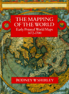
Look back to when the Americas were still the "New World", and mapmaking was still a fine art. Now available and in print at less than half its previous price, this oversized, painstakingly compiled classic collection of early printed maps from 1472 to 1700 portrays a revolution in progress. As explorers arrived in lands formerly unknown to Europe, and returned home with accounts of their travels, cartography changed to reflect new ideas. Over 600 examples in both color and black and white, range from the simple to the highly decorative. Isidore of Seville's 1472 small woodcut map -- the first ever printed -- portrays the world in miniature, with continents represented only in words. Hans Rust's elaborate medieval map (c. 1480), by contrast, has labels, scrolls, and dozens of small drawings. Francesco Rosselli's map, made roughly in 1508, already incorporates the Americas. A section of charts provides information on cartographic developments in a glance.
Read Less
Choose your shipping method in Checkout. Costs may vary based on destination.
Seller's Description:
VeryGood. Hardcover. Hardcover. 14" x 9.5". XLXXXVIII, 670 pp. B&W illustrations throughout text. Publisher's red cloth boards in an illustrated DJ. Small ink mark to top edge. Sunning to DJ's spine; price sticker to rear panel. Else Fine. ISBN 1853682713.
Choose your shipping method in Checkout. Costs may vary based on destination.
Seller's Description:
Good+ in a Good++ dust jacket; Hardcover; Withdrawn library copy with the standard library markings; Dust jacket is clean and intact with just minor edgewear, and has not been price-clipped (Now fitted with a new, Brodart jacket protector); Light wear to the boards; Library stamps to endpapers; Text pages clean & unmarked; Excellent binding with a straight spine; This book will be shipped in a sturdy cardboard box with foam padding; Extra-Large Format (Folio, 12.75"-14" tall); Heavy (8.6 lbs); Map illustration to jacket with title in tan lettering on a red background; 1993, New Holland Publishing; 720 pages; "The Mapping of the World: Early Printed World Maps 1472-1700, " by Rodney W. Shirley.
Choose your shipping method in Checkout. Costs may vary based on destination.
Seller's Description:
Very good. Very cle3an hardcover with jacket. no marks clean text. solid binding. very light wear. you will be very happy with the condition of this book. FAST SHIPPING W/ CONFIRMATION. NO PRIORITY OR INTERNATIONAL ORDERS OVER 4LBs.