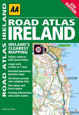
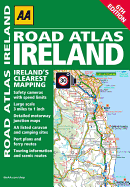
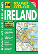
Updated from Ireland's Official Mapping Agencies, OSI and OSNI, the "AA Road Atlas Ireland" includes AA approved camping sites and AA recommended golf courses, car parks, picnic sites, port plans and ferry routes plus motorway strip maps including the M1 Toll Drogheda bypass. There are 11 detailed city and town plans: Belfast, Cork, Londonderry, Dublin, Dun, Laoghaire, Galway, Killkarney, Limerick, Sligo and Waterford; and an easy-to-read 3,500 place name index which including tourist sites.
Read More
Updated from Ireland's Official Mapping Agencies, OSI and OSNI, the "AA Road Atlas Ireland" includes AA approved camping sites and AA recommended golf courses, car parks, picnic sites, port plans and ferry routes plus motorway strip maps including the M1 Toll Drogheda bypass. There are 11 detailed city and town plans: Belfast, Cork, Londonderry, Dublin, Dun, Laoghaire, Galway, Killkarney, Limerick, Sligo and Waterford; and an easy-to-read 3,500 place name index which including tourist sites.
Read Less
Choose your shipping method in Checkout. Costs may vary based on destination.
Seller's Description:
Fair. This is a USED book, it is subject to external and interior wear including, underlining, highlighting, annotations, water damage, minor scuffs and tears. This is a donated book accepted as is. Stickers and sticker residue on the cover should be expected, as well as spine wear from use. There are NO codes or disc(s) included. All items ship Monday-Friday within 2-3 business days. Thank you for supporting Goodwill of OC.
Choose your shipping method in Checkout. Costs may vary based on destination.
Seller's Description:
Very Good. Very Good condition. A copy that may have a few cosmetic defects. May also contain light spine creasing or a few markings such as an owner's name, short gifter's inscription or light stamp.