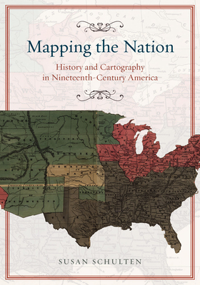
In the nineteenth century, Americans began to use maps in extraordinary new ways. Medical men mapped diseases to understand epidemics, natural scientists mapped climate to uncover weather patterns, and Northerners created slave maps to assess the power of the South. And after the Civil War, federal agencies embraced statistical and thematic mapping in order to profile the ethnic, racial, economic, moral, and physical attributes of a reunified nation. In Mapping the Nation, Susan Schulten charts how thematic maps ...
Read More
In the nineteenth century, Americans began to use maps in extraordinary new ways. Medical men mapped diseases to understand epidemics, natural scientists mapped climate to uncover weather patterns, and Northerners created slave maps to assess the power of the South. And after the Civil War, federal agencies embraced statistical and thematic mapping in order to profile the ethnic, racial, economic, moral, and physical attributes of a reunified nation. In Mapping the Nation, Susan Schulten charts how thematic maps demonstrated the analytical potential of cartography. This radical shift in spatial thought and representation opened the door to the idea that maps were not just illustrations of data, but visual tools that are uniquely equipped to convey complex ideas, changing forever the very meaning of a map.
Read Less
Choose your shipping method in Checkout. Costs may vary based on destination.
Seller's Description:
PLEASE NOTE, WE DO NOT SHIP TO DENMARK. New Book. Shipped from UK in 4 to 14 days. Established seller since 2000. Please note we cannot offer an expedited shipping service from the UK.
Choose your shipping method in Checkout. Costs may vary based on destination.
Seller's Description:
New. In the 19th century, Americans began to use maps in extraordinary new ways. Medical men mapped diseases to understand epidemics, natural scientists mapped climate to uncover weather patterns, and Northerners created slave maps to assess the power of the South. This book charts how thematic maps demonstrated the analytical potential of cartography. Num Pages: 272 pages, 47 halftones. BIC Classification: 1KBB; 3JH; HBJK; HBLL; HBTP; RGV. Category: (G) General (US: Trade). Dimension: 254 x 178 x 15. Weight in Grams: 463. 2013. Reprint. Paperback.....We ship daily from our Bookshop.
Choose your shipping method in Checkout. Costs may vary based on destination.
Seller's Description:
New. Trade paperback (US). Glued binding. 264 p. Contains: Unspecified. In Stock. 100% Money Back Guarantee. Brand New, Perfect Condition, allow 4-14 business days for standard shipping. To Alaska, Hawaii, U.S. protectorate, P.O. box, and APO/FPO addresses allow 4-28 business days for Standard shipping. No expedited shipping. All orders placed with expedited shipping will be cancelled. Over 3, 000, 000 happy customers.
Choose your shipping method in Checkout. Costs may vary based on destination.
Seller's Description:
Good-Bumped and creased book with tears to the extremities, but not affecting the text block, may have remainder mark or previous owner's name-GOOD PAPERBACK Standard-sized.
Choose your shipping method in Checkout. Costs may vary based on destination.
Seller's Description:
New. Trade paperback (US). Glued binding. 264 p. Contains: Unspecified. In Stock. 100% Money Back Guarantee. Brand New, Perfect Condition, allow 4-14 business days for standard shipping. To Alaska, Hawaii, U.S. protectorate, P.O. box, and APO/FPO addresses allow 4-28 business days for Standard shipping. No expedited shipping. All orders placed with expedited shipping will be cancelled. Over 3, 000, 000 happy customers.