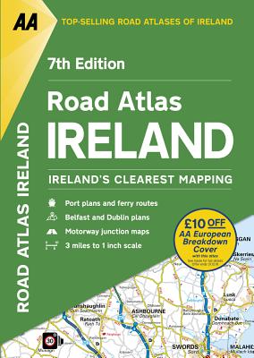
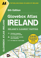
Updated from Ireland's Official Mapping Agencies, OSI and OSNI, the "AA Road Atlas Ireland" includes AA approved camping sites and AA recommended golf courses, car parks, picnic sites, port plans and ferry routes plus motorway strip maps including the M1 Toll Drogheda bypass. There are 11 detailed city and town plans: Belfast, Cork, Londonderry, Dublin, Dun, Laoghaire, Galway, Killkarney, Limerick, Sligo and Waterford; and an easy-to-read 3,500 place name index which including tourist sites.
Read More
Updated from Ireland's Official Mapping Agencies, OSI and OSNI, the "AA Road Atlas Ireland" includes AA approved camping sites and AA recommended golf courses, car parks, picnic sites, port plans and ferry routes plus motorway strip maps including the M1 Toll Drogheda bypass. There are 11 detailed city and town plans: Belfast, Cork, Londonderry, Dublin, Dun, Laoghaire, Galway, Killkarney, Limerick, Sligo and Waterford; and an easy-to-read 3,500 place name index which including tourist sites.
Read Less
Choose your shipping method in Checkout. Costs may vary based on destination.
Seller's Description:
Very good. **SHIPPED FROM UK** We believe you will be completely satisfied with our quick and reliable service. All orders are dispatched as swiftly as possible! Buy with confidence! Greener Books.
Choose your shipping method in Checkout. Costs may vary based on destination.
Seller's Description:
Very good. Simply Brit welcome to our online used book store, where affordability meets great quality. Dive into a world of captivating reads without breaking the bank. We take pride in offering a wide selection of used books, from classics to hidden gems, ensuring there's something for every literary palate. All orders are shipped within 24 hours and our lightning fast-delivery within 48 hours coupled with our prompt customer service ensures a smooth journey from ordering to delivery. Discover the joy of reading with us, your trusted source for affordable books that do not compromise on quality.
Choose your shipping method in Checkout. Costs may vary based on destination.
Seller's Description:
Very good. Connecting readers with great books since 1972! Used books may not include companion materials, and may have some shelf wear or limited writing. We ship orders daily and Customer Service is our top priority!
Choose your shipping method in Checkout. Costs may vary based on destination.
Seller's Description:
Fair. This is a USED book, it is subject to external and interior wear including, underlining, highlighting, annotations, water damage, minor scuffs and tears. This is a donated book accepted as is. Stickers and sticker residue on the cover should be expected, as well as spine wear from use. There are NO codes or disc(s) included. All items ship Monday-Friday within 2-3 business days. Thank you for supporting Goodwill of OC.
Choose your shipping method in Checkout. Costs may vary based on destination.
Seller's Description:
Very Good. Very Good condition. A copy that may have a few cosmetic defects. May also contain light spine creasing or a few markings such as an owner's name, short gifter's inscription or light stamp.