In the nineteenth century, Americans began to use maps in radically new ways. For the first time, medical men mapped diseases to understand and prevent epidemics, natural scientists mapped climate and rainfall to uncover weather patterns, educators mapped the past to foster national loyalty among students, and Northerners mapped slavery to assess the power of the South. After the Civil War, federal agencies embraced statistical and thematic mapping in order to profile the ethnic, racial, economic, moral, and physical ...
Read More
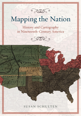
In the nineteenth century, Americans began to use maps in radically new ways. For the first time, medical men mapped diseases to understand and prevent epidemics, natural scientists mapped climate and rainfall to uncover weather patterns, educators mapped the past to foster national loyalty among students, and Northerners mapped slavery to assess the power of the South. After the Civil War, federal agencies embraced statistical and thematic mapping in order to profile the ethnic, racial, economic, moral, and physical attributes of a reunified nation. By the end of the century, Congress had authorized a national archive of maps, an explicit recognition that old maps were not relics to be discarded but unique records of the nation's past. All of these experiments involved the realization that maps were not just illustrations of data, but visual tools that were uniquely equipped to convey complex ideas and information. In Mapping the Nation , Susan Schulten charts how maps of epidemic disease, slavery, census statistics, the environment, and the past demonstrated the analytical potential of cartography, and in the process transformed the very meaning of a map. Today, statistical and thematic maps are so ubiquitous that we take for granted that data will be arranged cartographically. Whether for urban planning, public health, marketing, or political strategy, maps have become everyday tools of social organization, governance, and economics. The world we inhabit-saturated with maps and graphic information-grew out of this sea change in spatial thought and representation in the nineteenth century, when Americans learned to see themselves and their nation in new dimensions.
Read Less
Choose your shipping method in Checkout. Costs may vary based on destination.
Seller's Description:
Good-Bumped and creased book with tears to the extremities, but not affecting the text block, may have remainder mark or previous owner's name-GOOD PAPERBACK Standard-sized.
Choose your shipping method in Checkout. Costs may vary based on destination.
Seller's Description:
Good. Connecting readers with great books since 1972! Used textbooks may not include companion materials such as access codes, etc. May have some wear or writing/highlighting. We ship orders daily and Customer Service is our top priority!
Choose your shipping method in Checkout. Costs may vary based on destination.
Seller's Description:
New. Trade paperback (US). Glued binding. 264 p. Contains: Unspecified. In Stock. 100% Money Back Guarantee. Brand New, Perfect Condition, allow 4-14 business days for standard shipping. To Alaska, Hawaii, U.S. protectorate, P.O. box, and APO/FPO addresses allow 4-28 business days for Standard shipping. No expedited shipping. All orders placed with expedited shipping will be cancelled. Over 3, 000, 000 happy customers.
Choose your shipping method in Checkout. Costs may vary based on destination.
Seller's Description:
PLEASE NOTE, WE DO NOT SHIP TO DENMARK. New Book. Shipped from UK in 4 to 14 days. Established seller since 2000. Please note we cannot offer an expedited shipping service from the UK.
Choose your shipping method in Checkout. Costs may vary based on destination.
Seller's Description:
New. Trade paperback (US). Glued binding. 264 p. Contains: Unspecified. In Stock. 100% Money Back Guarantee. Brand New, Perfect Condition, allow 4-14 business days for standard shipping. To Alaska, Hawaii, U.S. protectorate, P.O. box, and APO/FPO addresses allow 4-28 business days for Standard shipping. No expedited shipping. All orders placed with expedited shipping will be cancelled. Over 3, 000, 000 happy customers.