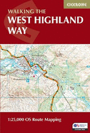
All the mapping you need to complete the 95 mile (153km) West Highland Way, an official Scottish Long Distance Route from Milngavie near Glasgow to Fort William. Showcasing the wild beauty of western Scotland, the trail is a journey from the lowlands to the highlands, passing Loch Lomond then crossing Rannoch Moor before finishing in the shadow of Britain's highest mountain, Ben Nevis. The walk takes roughly a week to complete and is presented in seven stages ranging from 8 to 20 miles. This booklet of Ordnance ...
Read More
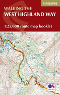
All the mapping you need to complete the 95 mile (153km) West Highland Way, an official Scottish Long Distance Route from Milngavie near Glasgow to Fort William. Showcasing the wild beauty of western Scotland, the trail is a journey from the lowlands to the highlands, passing Loch Lomond then crossing Rannoch Moor before finishing in the shadow of Britain's highest mountain, Ben Nevis. The walk takes roughly a week to complete and is presented in seven stages ranging from 8 to 20 miles. This booklet of Ordnance Survey 1:25,000 Explorer maps has been designed for convenient use on the West Highland Way. It shows the full and up-to-date line of the route along with the relevant extract from the OS Explorer map legend, and can be used when walking the trail in either direction. Conveniently sized for slipping into a jacket pocket or the top of a rucksack. NOTE An accompanying Cicerone guidebook - The West Highland Way ISBN9781852848576 - describes the full route with lots of other practical, historical and cultural information. The guidebook INCLUDES a copy of this map booklet.
Read Less
Choose your shipping method in Checkout. Costs may vary based on destination.
Seller's Description:
Fine. In Stock. 100% Money Back Guarantee. Brand New, Perfect Condition, allow 4-14 business days for standard shipping. To Alaska, Hawaii, U.S. protectorate, P.O. box, and APO/FPO addresses allow 4-28 business days for Standard shipping. No expedited shipping. All orders placed with expedited shipping will be cancelled. Over 3, 000, 000 happy customers.
Choose your shipping method in Checkout. Costs may vary based on destination.
Seller's Description:
New. In Stock. 100% Money Back Guarantee. Brand New, Perfect Condition, allow 4-14 business days for standard shipping. To Alaska, Hawaii, U.S. protectorate, P.O. box, and APO/FPO addresses allow 4-28 business days for Standard shipping. No expedited shipping. All orders placed with expedited shipping will be cancelled. Over 3, 000, 000 happy customers.
Choose your shipping method in Checkout. Costs may vary based on destination.
Seller's Description:
PLEASE NOTE, WE DO NOT SHIP TO DENMARK. New Audiobook. Shipped from UK in 4 to 14 days. Established seller since 2000. Please note we cannot offer an expedited shipping service from the UK.
Choose your shipping method in Checkout. Costs may vary based on destination.
Seller's Description:
PLEASE NOTE, WE DO NOT SHIP TO DENMARK. New Audiobook. Shipped from UK in 4 to 14 days. Established seller since 2000. Please note we cannot offer an expedited shipping service from the UK.
Choose your shipping method in Checkout. Costs may vary based on destination.
Seller's Description:
Fine. In Stock. 100% Money Back Guarantee. Brand New, Perfect Condition, allow 4-14 business days for standard shipping. To Alaska, Hawaii, U.S. protectorate, P.O. box, and APO/FPO addresses allow 4-28 business days for Standard shipping. No expedited shipping. All orders placed with expedited shipping will be cancelled. Over 3, 000, 000 happy customers.
Choose your shipping method in Checkout. Costs may vary based on destination.
Seller's Description:
New. In Stock. 100% Money Back Guarantee. Brand New, Perfect Condition, allow 4-14 business days for standard shipping. To Alaska, Hawaii, U.S. protectorate, P.O. box, and APO/FPO addresses allow 4-28 business days for Standard shipping. No expedited shipping. All orders placed with expedited shipping will be cancelled. Over 3, 000, 000 happy customers.