In the late 19th century, Britain's middle class enjoyed greater leisure time and disposable income than previous generations, enabling families to travel further afield for day trips and holidays. The Isle of Wight was easily accessible from southern England by taking a train to Portsmouth or Southampton and then crossing the Solent by 'steamer' to Ryde or Cowes. The transport network on the island was well-developed and it was possible to reach almost every town and village by train, horse-drawn coach or coastal ferry. ...
Read More
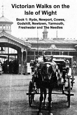
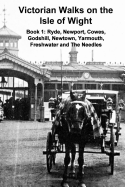
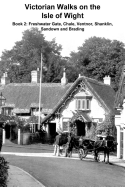
In the late 19th century, Britain's middle class enjoyed greater leisure time and disposable income than previous generations, enabling families to travel further afield for day trips and holidays. The Isle of Wight was easily accessible from southern England by taking a train to Portsmouth or Southampton and then crossing the Solent by 'steamer' to Ryde or Cowes. The transport network on the island was well-developed and it was possible to reach almost every town and village by train, horse-drawn coach or coastal ferry. Detailed guide books were available to help tourists make the most of their visit and this 53 page booklet reproduces text from 'Black's Guide to the Isle of Wight', published in 1883. It includes information about transport services but the author assumes that readers will walk to the 'attractions' he describes, taking in the scenery as they ramble. Accordingly, he explains where to go, how to get there, what to look for and provides the history of places visited. This booklet covers the north and west coasts and most of the central, inland area. Book 2 focuses on the south coast from Freshwater Gate through Brixton, Chale, Ventnor, Shanklin and Sandown to Brading. The nine photographs are from the Keasbury-Gordon Photograph Archive and date from the 1880s to the 1920s. The text is remarkably detailed and enables us to travel back in time to visit this delightful, historically important, British isle.
Read Less