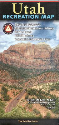
The Utah Recreation Map is a folded map version of the Recreation Guide pages within our Utah Road & Recreation Atlas. The Utah Recreation Map is the ideal planning tool for everything outdoors, from a nearby day-hike to a vacation adventure in one of Utah's rugged parks and wilderness areas. It's the only Utah map that benefits from Benchmark's field-checked accuracy and cartographic excellence. The state map features Public Lands, extensive highway detail, point-to-point mileages, recreation attractions, campgrounds, ...
Read More
The Utah Recreation Map is a folded map version of the Recreation Guide pages within our Utah Road & Recreation Atlas. The Utah Recreation Map is the ideal planning tool for everything outdoors, from a nearby day-hike to a vacation adventure in one of Utah's rugged parks and wilderness areas. It's the only Utah map that benefits from Benchmark's field-checked accuracy and cartographic excellence. The state map features Public Lands, extensive highway detail, point-to-point mileages, recreation attractions, campgrounds, parks & wildlife areas, boating & fishing access points, and hunting units (GMU). The reverse side features a regional map of Salt Lake City and the Wasatch Front, and includes statewide categorized POI listings with helpful descriptions, current contact information, and map grid references.
Read Less
Choose your shipping method in Checkout. Costs may vary based on destination.
Seller's Description:
This item is in overall good condition. Covers and dust jackets are intact but may have minor wear including slight curls or bends to corners as well as cosmetic blemishes including stickers. Pages are intact but may have minor highlighting/ writing. Binding is intact; however, spine may have slight wear overall. Digital codes may not be included and have not been tested to be redeemable and/or active. Minor shelf wear overall. Please note that all items are donated goods and are in used condition. Orders shipped Monday through Friday! Your purchase helps put people to work and learn life skills to reach their full potential. Orders shipped Monday through Friday. Your purchase helps put people to work and learn life skills to reach their full potential. Thank you!
Choose your shipping method in Checkout. Costs may vary based on destination.
Seller's Description:
New. The Utah Recreation Map is the ideal planning tool for everything outdoors, from a rugged backcountry adventure to a nearby day-hike. It's the only Utah folded map that benefits from Benchmark's renowned field-checking, proven accuracy, and cartographic excellence. The Utah Recreation Map features: Extensive backroad detail Over 350 campground listings Forests & Wildlife areas Boating & Fishing areas Parks & Monuments Complete Information Resources Comprehensive Index Two-sided, self-cover, paper map. Size: Folded = 4.25" x 8.875" Unfolded = 26.25" x 33.75" Recreational Maps: Benchmarks Recreation Maps were created for outdoor lovers who want the high quality recreation information in our atlases but with the convenience of a traditional folding map. Complete public lands detail and hunting unit boundaries are shown as well as categorized recreation listings.
Choose your shipping method in Checkout. Costs may vary based on destination.
Seller's Description:
New. The Utah Recreation Map is a folded map version of the Recreation Guide pages within their Utah Road & Recreation Atlas. The Utah Recreation Map is the ideal planning tool for everything outdoors, from a nearby day-hike to a vacation adventure in one of Utah's rugged parks and wilderness areas. It's the only Utah map that benefits from Benchmark's field-checked accuracy and cartographic excellence. The state map features Public Lands, extensive highway detail, point-to-point mileages, recreation attractions, campgrounds, parks & wildlife areas, boating & fishing access points, and hunting units (GMU). The reverse side features a regional map of Salt Lake City and the Wasatch Front, and includes statewide categorized POI listings with helpful descriptions, current contact information, and map grid references. ISBN: 9780783499192 Cover: 4.25" × 9" Sheet: 26.5" × 34" Map side (Scale 1: 730, 000)