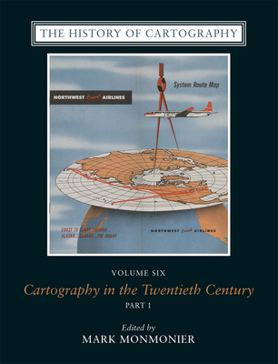
From satellite imaging techniques to the Internet, the technologies of the twentieth century transformed both the production and consumption of maps. Volume 6 of the authoritative "History of Cartography" series covers this pivotal century, in which mapping became an important tool for coping with complexity, organizing knowledge, and influencing public opinion in all parts of the globe and at all levels of society. The first volume in the long-running series to be arranged in encyclopedic format, it includes 529 articles ...
Read More
From satellite imaging techniques to the Internet, the technologies of the twentieth century transformed both the production and consumption of maps. Volume 6 of the authoritative "History of Cartography" series covers this pivotal century, in which mapping became an important tool for coping with complexity, organizing knowledge, and influencing public opinion in all parts of the globe and at all levels of society. The first volume in the long-running series to be arranged in encyclopedic format, it includes 529 articles ranging from short biographical sketches of key individuals and institutions to multipart entries on such broad topics as Topographic Mapping, Military Mapping by Major Powers, and Wayfinding and Travel Maps. Editor Mark Monmonier and more than 300 expert contributors offer both original factual researchoften based on their own participation in the developments they describeand interpretation of larger trends in cartography. Each entry includes bibliographical references, and the volume is illustrated with more than 1,100 images, the majority of them in full color."
Read Less
Choose your shipping method in Checkout. Costs may vary based on destination.
Seller's Description:
2-vol set. Jumbo-sized. Good-Bumped and creased book with tears to the extremities, but not affecting the text block, may have remainder mark or previous owner's name-GOOD.
Choose your shipping method in Checkout. Costs may vary based on destination.
Seller's Description:
New. The twentieth century is a pivotal period in map history. Geographic information systems radically altered cartographic institutions and reduced the skill required to create maps. This volume features expert contributors who provide both original research, and interpretations of larger trends in cartography. Editor(s): Monmonier, Mark. Num Pages: 1728 pages, 2 books, 805 colour plates, 119 halftones, 242 line drawings, 61 tables. BIC Classification: 3JJ; HBTP; RGV; TBX. Category: (G) General (US: Trade). Dimension: 309 x 303 x 120. Weight in Grams: 7774. 2015. Hardcover.....We ship daily from our Bookshop.
Choose your shipping method in Checkout. Costs may vary based on destination.
Seller's Description:
PLEASE NOTE, WE DO NOT SHIP TO DENMARK. New Book. Shipped from UK in 4 to 14 days. Established seller since 2000. Please note we cannot offer an expedited shipping service from the UK.
Choose your shipping method in Checkout. Costs may vary based on destination.
Seller's Description:
PLEASE NOTE, WE DO NOT SHIP TO DENMARK. New Book. Shipped from UK in 4 to 14 days. Established seller since 2000. Please note we cannot offer an expedited shipping service from the UK.