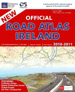
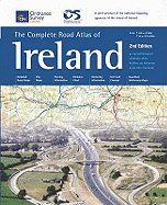
This road atlas is a joint publication between Ordnance Survey of Northern Ireland and Ordnance Survey of Ireland. The main body of the atlas contains 70 pages derived from the 1:210,000 scale Holiday Map Series with coloured street maps of 21 of the major towns and ferry ports. It includes a gazetteer to assist in the rapid location of cities, towns and villages, each with a page and grid reference. Designed especially for the motorist and spiral bound for easy use, this atlas includes other useful information such as full ...
Read More
This road atlas is a joint publication between Ordnance Survey of Northern Ireland and Ordnance Survey of Ireland. The main body of the atlas contains 70 pages derived from the 1:210,000 scale Holiday Map Series with coloured street maps of 21 of the major towns and ferry ports. It includes a gazetteer to assist in the rapid location of cities, towns and villages, each with a page and grid reference. Designed especially for the motorist and spiral bound for easy use, this atlas includes other useful information such as full colour illustrations of road signs, a route planning map, distance tables, conversion tables, emergency routes, a golf course location guide and motoring organisations' addresses and telephone numbers.
Read Less
Add this copy of The Complete Road Atlas of Ireland to cart. $6.99, very good condition, Sold by Brit Books rated 4.0 out of 5 stars, ships from Milton Keynes, BUCKINGHAMSHIRE, UNITED KINGDOM, published 2001 by Ordnance Survey.
Choose your shipping method in Checkout. Costs may vary based on destination.
Seller's Description:
Very good. Simply Brit welcome to our online used book store, where affordability meets great quality. Dive into a world of captivating reads without breaking the bank. We take pride in offering a wide selection of used books, from classics to hidden gems, ensuring there's something for every literary palate. All orders are shipped within 24 hours and our lightning fast-delivery within 48 hours coupled with our prompt customer service ensures a smooth journey from ordering to delivery. Discover the joy of reading with us, your trusted source for affordable books that do not compromise on quality.
Add this copy of The Complete Road Atlas of Ireland to cart. $79.19, good condition, Sold by Bonita rated 4.0 out of 5 stars, ships from Newport Coast, CA, UNITED STATES, published 2001 by Ordnance Survey of Ireland.