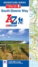
The A-Z Adventure Series of maps combines the best of OS and A-Z, creating the perfect companion for walkers, off-road cyclists, horse riders and anyone wishing to explore the great outdoors. The South Downs Way is a National Trail along the chalk escarpments and ridges of the South Downs. This undulating path begins in Winchester and finishes in Eastbourne covering 100 miles (160km) and lies completely within the South Downs National Park. The route on the map is clearly highlighted in yellow with mileage markers ...
Read More
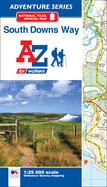
The A-Z Adventure Series of maps combines the best of OS and A-Z, creating the perfect companion for walkers, off-road cyclists, horse riders and anyone wishing to explore the great outdoors. The South Downs Way is a National Trail along the chalk escarpments and ridges of the South Downs. This undulating path begins in Winchester and finishes in Eastbourne covering 100 miles (160km) and lies completely within the South Downs National Park. The route on the map is clearly highlighted in yellow with mileage markers to gauge distances when planning sections of the walk to enjoy. This official National Trail Map* of the South Downs Way features 44 pages of continuous Ordnance Survey 1:25000 mapping providing complete coverage of the South Downs Way. This atlas includes a route planner showing distances between places and the amenities available, featuring: Campsites (seasonal opening) Information Centres Hotels/B&Bs Youth Hostels Public Houses Shops Restaurants Cafes (seasonal opening) Petrol Stations Also featured is advice on safety and security when walking and a selection of QR codes linked to useful websites, including temporary route updates from the National Trails, regional information, map reading advice and weather reports. Unlike the original OS sheets, this A-Z Adventure Atlas includes a comprehensive index to towns, villages, hamlets and locations, natural features, nature reserves, car parks and youth hostels, making it easy to find the required location quickly. Each index entry has a page reference and a six figure National Grid Reference. With a book size of 240mm x 134mm it is the same size as a standard folded OS map. Other National Trails available within the A-Z Adventure series include: Cotswold Way, Hadrian's Wall Path, North Downs Way, Offa's Dyke Path, Pembrokeshire Coast Path, Pennine Way, SW Coast Path, Thames Path and The Ridgeway. *A-Z is the official mapping partner of the National Trails.
Read Less
Choose your shipping method in Checkout. Costs may vary based on destination.
Seller's Description:
Fine. Glued binding. -Z Adventure Series . In Stock. 100% Money Back Guarantee. Brand New, Perfect Condition, allow 4-14 business days for standard shipping. To Alaska, Hawaii, U.S. protectorate, P.O. box, and APO/FPO addresses allow 4-28 business days for Standard shipping. No expedited shipping. All orders placed with expedited shipping will be cancelled. Over 3, 000, 000 happy customers.
Choose your shipping method in Checkout. Costs may vary based on destination.
Seller's Description:
New. Glued binding. -Z Adventure Series . In Stock. 100% Money Back Guarantee. Brand New, Perfect Condition, allow 4-14 business days for standard shipping. To Alaska, Hawaii, U.S. protectorate, P.O. box, and APO/FPO addresses allow 4-28 business days for Standard shipping. No expedited shipping. All orders placed with expedited shipping will be cancelled. Over 3, 000, 000 happy customers.
Choose your shipping method in Checkout. Costs may vary based on destination.
Seller's Description:
PLEASE NOTE, WE DO NOT SHIP TO DENMARK. New Book. Shipped from UK in 4 to 14 days. Established seller since 2000. Please note we cannot offer an expedited shipping service from the UK.
Choose your shipping method in Checkout. Costs may vary based on destination.
Seller's Description:
PLEASE NOTE, WE DO NOT SHIP TO DENMARK. New Book. Shipped from UK in 4 to 14 days. Established seller since 2000. Please note we cannot offer an expedited shipping service from the UK.