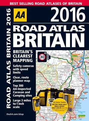
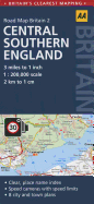
This top-selling A4 road atlas showcases Britain's clearest mapping at 3.2 miles to one inch. It features 104 city, town, and port plans, the top 300 AA-inspected caravan and camping sites, over 220 service areas, and updated speed cameras with speed limits. This top-selling road atlas showcases Britain's clearest mapping from the experts at the AA. Each page has been titled with its geographical location so you can turn to the page you need more easily. Static speed camera locations with speed limits are pinpointed. Wide ...
Read More
This top-selling A4 road atlas showcases Britain's clearest mapping at 3.2 miles to one inch. It features 104 city, town, and port plans, the top 300 AA-inspected caravan and camping sites, over 220 service areas, and updated speed cameras with speed limits. This top-selling road atlas showcases Britain's clearest mapping from the experts at the AA. Each page has been titled with its geographical location so you can turn to the page you need more easily. Static speed camera locations with speed limits are pinpointed. Wide minor roads, National Trust, English, and World Heritage, crematorium locations, and other hard-to-find places are also shown. There are 104 city, town and port plans, full-color county, unitary, and administrative area map and a comprehensive 31,500 entry index with airports, top tourist sites, and motorway services listed. Plus, scenic routes, tourist sites with satnav friendly postcodes, and caravan and camping sites symbolized on the mapping. The paper in this atlas is produced from environmentally sustainable resources.
Read Less