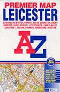
This coloured foldout street map of Leicester covers an area which extends to Anstey, Cropston, Thurcaston, Wanlip, Syston, Thurmaston, Hamilton, Scraptoft, Stoughton, Wigston, Blaby, Whetstone, Narborough, Huncote, Leicester Forest East, Kirby Muxloe, Ratby and Groby. Also included is a large scale Leicester city centre inset map and an index to streets, selected flats, walkways and places of interest.
Read More
This coloured foldout street map of Leicester covers an area which extends to Anstey, Cropston, Thurcaston, Wanlip, Syston, Thurmaston, Hamilton, Scraptoft, Stoughton, Wigston, Blaby, Whetstone, Narborough, Huncote, Leicester Forest East, Kirby Muxloe, Ratby and Groby. Also included is a large scale Leicester city centre inset map and an index to streets, selected flats, walkways and places of interest.
Read Less
Choose your shipping method in Checkout. Costs may vary based on destination.
Seller's Description:
Very good. **SHIPPED FROM UK** We believe you will be completely satisfied with our quick and reliable service. All orders are dispatched as swiftly as possible! Buy with confidence! Greener Books.
Choose your shipping method in Checkout. Costs may vary based on destination.
Seller's Description:
Very good. Simply Brit welcome to our online used book store, where affordability meets great quality. Dive into a world of captivating reads without breaking the bank. We take pride in offering a wide selection of used books, from classics to hidden gems, ensuring there's something for every literary palate. All orders are shipped within 24 hours and our lightning fast-delivery within 48 hours coupled with our prompt customer service ensures a smooth journey from ordering to delivery. Discover the joy of reading with us, your trusted source for affordable books that do not compromise on quality.