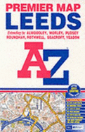
This coloured foldout street map of Leeds extends to Rawdon, Alwoodley, Slaid Hill, Whinmoor, Scholes, Swillington, Wood Row, Rothwell, Middleton, Moorley, Drighlington, Birkenshaw, Pudsey, and Calverley. A large scale city centre plan of Leeds is featured. Attached to the cover is a booklet containing the index that lists streets, selected flats, walkways and places of interest and place and area names covered by this map.
Read More
This coloured foldout street map of Leeds extends to Rawdon, Alwoodley, Slaid Hill, Whinmoor, Scholes, Swillington, Wood Row, Rothwell, Middleton, Moorley, Drighlington, Birkenshaw, Pudsey, and Calverley. A large scale city centre plan of Leeds is featured. Attached to the cover is a booklet containing the index that lists streets, selected flats, walkways and places of interest and place and area names covered by this map.
Read Less