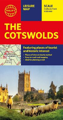
This leisure and tourist map of The Cotswolds gives detailed coverage of the area's road network, ranging from Abingdon in the east to Gloucester in the west, and from Swindon in the south to Great Malvern in the north, at a scale of approximately 2 miles to 1 inch. There is an index to place names with counties on the reverse of the map.The map shows places of tourist and historic interest, including castles, camping sites, country parks, galleries, gardens, golf courses, marinas, museums, nature trails, historic sites, ...
Read More
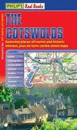
This leisure and tourist map of The Cotswolds gives detailed coverage of the area's road network, ranging from Abingdon in the east to Gloucester in the west, and from Swindon in the south to Great Malvern in the north, at a scale of approximately 2 miles to 1 inch. There is an index to place names with counties on the reverse of the map.The map shows places of tourist and historic interest, including castles, camping sites, country parks, galleries, gardens, golf courses, marinas, museums, nature trails, historic sites, sports venues, theatres, theme parks, wildlife parks and zoos. An index to principal places of interest is featured on the map.Indexed town-centre street maps for Bourton-on-the-Water, Cheltenham, Cirencester, Gloucester, Tewkesbury and Winchcombe are also included.In a convenient folded format, this double-sided sheet map is ideally suited for both leisure and business use, whether by locals or visitors.
Read Less
Choose your shipping method in Checkout. Costs may vary based on destination.
Seller's Description:
Good. Simply Brit welcome to our online used book store, where affordability meets great quality. Dive into a world of captivating reads without breaking the bank. We take pride in offering a wide selection of used books, from classics to hidden gems, ensuring there's something for every literary palate. All orders are shipped within 24 hours and our lightning fast-delivery within 48 hours coupled with our prompt customer service ensures a smooth journey from ordering to delivery. Discover the joy of reading with us, your trusted source for affordable books that do not compromise on quality.
Choose your shipping method in Checkout. Costs may vary based on destination.
Seller's Description:
Good. All orders are dispatched within 1 working day from our UK warehouse. Established in 2004, we are dedicated to recycling unwanted books on behalf of a number of UK charities who benefit from added revenue through the sale of their books plus huge savings in waste disposal. No quibble refund if not completely satisfied.
Choose your shipping method in Checkout. Costs may vary based on destination.
Seller's Description:
PLEASE NOTE, WE DO NOT SHIP TO DENMARK. New Book. Shipped from UK in 4 to 14 days. Established seller since 2000. Please note we cannot offer an expedited shipping service from the UK.
Choose your shipping method in Checkout. Costs may vary based on destination.
Seller's Description:
PLEASE NOTE, WE DO NOT SHIP TO DENMARK. New Book. Shipped from UK in 4 to 14 days. Established seller since 2000. Please note we cannot offer an expedited shipping service from the UK.