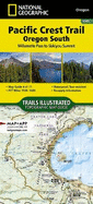
The Pacific Crest Trail (PCT) covered in the Oregon South Topographic Map Guide mostly travels below the high mountain tops and ridges, skirting the bases of the enormous volcanoes of Diamond Peak, Mount Thielsen, and Mount Mazama (home to Crater Lake). Winding south of Ashland and towards the border with California, it enters the Klamath Mountains ecoregion. Here the volcanoes are replaced by mountains and foothills, canyons and valleys, and small ponds and lakes. Highlights of this section include the Diamond Peak, Mount ...
Read More
The Pacific Crest Trail (PCT) covered in the Oregon South Topographic Map Guide mostly travels below the high mountain tops and ridges, skirting the bases of the enormous volcanoes of Diamond Peak, Mount Thielsen, and Mount Mazama (home to Crater Lake). Winding south of Ashland and towards the border with California, it enters the Klamath Mountains ecoregion. Here the volcanoes are replaced by mountains and foothills, canyons and valleys, and small ponds and lakes. Highlights of this section include the Diamond Peak, Mount Thielsen, Sky Lakes, and Soda Mountain wilderness areas, as well as Crater Lake National Park and Cascade-Siskiyou National Monument. The PCT spans 2,650 miles from the Canadian border, through Washington, Oregon, and California to the southern terminus on the Mexican border. The famous trail crosses some of the most wild and scenic landscapes of the western U.S., including six national parks, 25 national forests, 48 wilderness areas, the volcanic Cascade Range of t
Read Less


![Pacific Crest Trail: Oregon South Map [Willamette Pass to Siskiyou Summit] (National Geographic Topographic Map Guide, 1005)](https://www4.alibris-static.com/isbn/9781566957113_t.gif)