A booklet of all the mapping needed to complete Offa's Dyke Path National Trail, following Britain's longest ancient monument: the eighth century earthwork that once marked the boundary between the Anglo-Saxon kingdom of Mercia and the Welsh kingdoms to the east. The 285km (177 mile) route from Sedbury Cliffs near Chepstow to Prestatyn is suitable for walkers of most abilities. The full route line is shown on 1:25,000 OS maps The map booklet can be used to walk the trail in either direction Sized to easily fit in ...
Read More
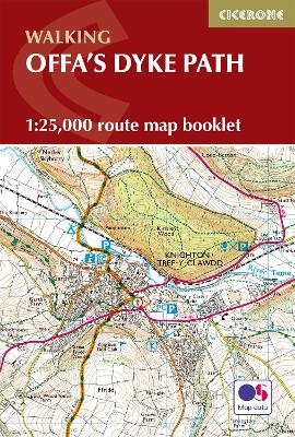
A booklet of all the mapping needed to complete Offa's Dyke Path National Trail, following Britain's longest ancient monument: the eighth century earthwork that once marked the boundary between the Anglo-Saxon kingdom of Mercia and the Welsh kingdoms to the east. The 285km (177 mile) route from Sedbury Cliffs near Chepstow to Prestatyn is suitable for walkers of most abilities. The full route line is shown on 1:25,000 OS maps The map booklet can be used to walk the trail in either direction Sized to easily fit in a jacket pocket The relevant extract from the OS Explorer map legend is included An accompanying Cicerone guidebook - Offa's Dyke Path is also available, which includes a copy of this map booklet
Read Less
Choose your shipping method in Checkout. Costs may vary based on destination.
Seller's Description:
PLEASE NOTE, WE DO NOT SHIP TO DENMARK. New Audiobook. Shipped from UK in 4 to 14 days. Established seller since 2000. Please note we cannot offer an expedited shipping service from the UK.
Choose your shipping method in Checkout. Costs may vary based on destination.
Seller's Description:
Fine. In Stock. 100% Money Back Guarantee. Brand New, Perfect Condition, allow 4-14 business days for standard shipping. To Alaska, Hawaii, U.S. protectorate, P.O. box, and APO/FPO addresses allow 4-28 business days for Standard shipping. No expedited shipping. All orders placed with expedited shipping will be cancelled. Over 3, 000, 000 happy customers.
Choose your shipping method in Checkout. Costs may vary based on destination.
Seller's Description:
PLEASE NOTE, WE DO NOT SHIP TO DENMARK. New Audiobook. Shipped from UK in 4 to 14 days. Established seller since 2000. Please note we cannot offer an expedited shipping service from the UK.
Choose your shipping method in Checkout. Costs may vary based on destination.
Seller's Description:
Fine. In Stock. 100% Money Back Guarantee. Brand New, Perfect Condition, allow 4-14 business days for standard shipping. To Alaska, Hawaii, U.S. protectorate, P.O. box, and APO/FPO addresses allow 4-28 business days for Standard shipping. No expedited shipping. All orders placed with expedited shipping will be cancelled. Over 3, 000, 000 happy customers.