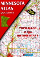
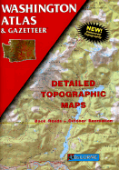
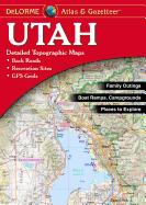
DeLorme's Atlas and Gazetteer Series is America's most popular line of recreational maps! Each atlas covers an individual state in its entirety with detailed, full-color topographic maps. Detail includes back roads, hidden lakes, boat ramps, hiking trails, campgrounds, public lands, forests, wetlands and more. And, the Gazetteer sections feature page after page of information on places to go and things to do. These atlases are year-round favorites with outdoors enthusiasts and anyone who likes to leave the main roads behind.
Read More
DeLorme's Atlas and Gazetteer Series is America's most popular line of recreational maps! Each atlas covers an individual state in its entirety with detailed, full-color topographic maps. Detail includes back roads, hidden lakes, boat ramps, hiking trails, campgrounds, public lands, forests, wetlands and more. And, the Gazetteer sections feature page after page of information on places to go and things to do. These atlases are year-round favorites with outdoors enthusiasts and anyone who likes to leave the main roads behind.
Read Less
Choose your shipping method in Checkout. Costs may vary based on destination.
Seller's Description:
Very good. Connecting readers with great books since 1972! Used books may not include companion materials, and may have some shelf wear or limited writing. We ship orders daily and Customer Service is our top priority!
Choose your shipping method in Checkout. Costs may vary based on destination.
Seller's Description:
Very good. A well-cared-for item that has seen limited use but remains in great condition. The item is complete, unmarked, and undamaged, but may show some limited signs of wear. Item works perfectly. Pages are intact and not marred by notes or highlighting. The spine is undamaged.
Choose your shipping method in Checkout. Costs may vary based on destination.
Seller's Description:
Very Good. Very Good condition. A copy that may have a few cosmetic defects. May also contain light spine creasing or a few markings such as an owner's name, short gifter's inscription or light stamp. Bundled media such as CDs, DVDs, floppy disks or access codes may not be included.
Choose your shipping method in Checkout. Costs may vary based on destination.
Seller's Description:
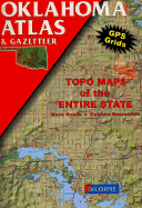
Very Good. 11x15. 88 page tall center stapled paperback-Topo Maps of the entire state. Recreation features, hunting and fishing, campsites, ligthhouses, etc. Second Edition (1993) of the 1992 original. Unmarked, tight and clean.