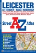
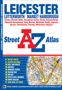
This A-Z map of Leicester is a full colour paperback featuring 62 pages of street mapping covering: *Anstey *Birstall *Blaby *Broughton Astley *Cosby *Countesthorpe *Kibworth Beauchamp *Kirby Muxloe *Leicester Airport *Markfield *Oadby *Sapcote *Syston *Thurmaston *Thurnby *Whetstone *Wigston There is separate coverage of Lutterworth and Market Harborough and a large scale city centre map of Leicester. Postcode districts, one-way streets and safety camera locations with maximum speeds are featured on the ...
Read More
This A-Z map of Leicester is a full colour paperback featuring 62 pages of street mapping covering: *Anstey *Birstall *Blaby *Broughton Astley *Cosby *Countesthorpe *Kibworth Beauchamp *Kirby Muxloe *Leicester Airport *Markfield *Oadby *Sapcote *Syston *Thurmaston *Thurnby *Whetstone *Wigston There is separate coverage of Lutterworth and Market Harborough and a large scale city centre map of Leicester. Postcode districts, one-way streets and safety camera locations with maximum speeds are featured on the mapping. A postcode map and a road map of the Leicester area are also included. The index section lists streets, selected flats, walkways and places of interest, place, area and station names, hospitals and hospices covered by this atlas.
Read Less
Choose your shipping method in Checkout. Costs may vary based on destination.
Seller's Description:
Very good. Simply Brit welcome to our online used book store, where affordability meets great quality. Dive into a world of captivating reads without breaking the bank. We take pride in offering a wide selection of used books, from classics to hidden gems, ensuring there's something for every literary palate. All orders are shipped within 24 hours and our lightning fast-delivery within 48 hours coupled with our prompt customer service ensures a smooth journey from ordering to delivery. Discover the joy of reading with us, your trusted source for affordable books that do not compromise on quality.
Choose your shipping method in Checkout. Costs may vary based on destination.
Seller's Description:
Good. Simply Brit welcome to our online used book store, where affordability meets great quality. Dive into a world of captivating reads without breaking the bank. We take pride in offering a wide selection of used books, from classics to hidden gems, ensuring there's something for every literary palate. All orders are shipped within 24 hours and our lightning fast-delivery within 48 hours coupled with our prompt customer service ensures a smooth journey from ordering to delivery. Discover the joy of reading with us, your trusted source for affordable books that do not compromise on quality.