Today, yachts are often equipped with radar, GPS, chart plotters, AIS, etc. This equipment has also become much more reliable, making it possible to make long offshore passages without a great knowledge of navigation. However, such equipment can be set up wrongly, interpreted incorrectly, malfunction or lose power. In these circumstances, knowledge of traditional navigation can become extremely important. This book will teach you how to navigate in the traditional way using compass, log and plotter; and also how to ...
Read More
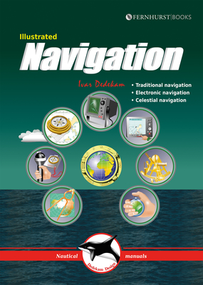
Today, yachts are often equipped with radar, GPS, chart plotters, AIS, etc. This equipment has also become much more reliable, making it possible to make long offshore passages without a great knowledge of navigation. However, such equipment can be set up wrongly, interpreted incorrectly, malfunction or lose power. In these circumstances, knowledge of traditional navigation can become extremely important. This book will teach you how to navigate in the traditional way using compass, log and plotter; and also how to navigate using electronic aids like GPS, radar and chart plotter. In addition, you will learn some basic celestial navigation using the sun and stars to obtain your position using sextant, almanacs, tables and a watch. Each method of navigation is explained alongside detailed illustrations and examples, combining to make a straightforward and easy-to-follow guide. Due to the design of the book, we have had to restrict the layout of the ebook to PDF style which may result in giving you a more restricted reading experience. For this reason, we would not recommend viewing it on very small screens.
Read Less
Choose your shipping method in Checkout. Costs may vary based on destination.
Seller's Description:
New. Contains: Illustrations, color. Illustrated Nautical Manuals . Includes: illustrations, color. Intended for professional and scholarly audience. In Stock. 100% Money Back Guarantee. Brand New, Perfect Condition, allow 4-14 business days for standard shipping. To Alaska, Hawaii, U.S. protectorate, P.O. box, and APO/FPO addresses allow 4-28 business days for Standard shipping. No expedited shipping. All orders placed with expedited shipping will be cancelled. Over 3, 000, 000 happy customers.
Choose your shipping method in Checkout. Costs may vary based on destination.
Seller's Description:
PLEASE NOTE, WE DO NOT SHIP TO DENMARK. New Book. Shipped from UK in 4 to 14 days. Established seller since 2000. Please note we cannot offer an expedited shipping service from the UK.
Choose your shipping method in Checkout. Costs may vary based on destination.
Seller's Description:
PLEASE NOTE, WE DO NOT SHIP TO DENMARK. New Book. Shipped from UK in 4 to 14 days. Established seller since 2000. Please note we cannot offer an expedited shipping service from the UK.
Choose your shipping method in Checkout. Costs may vary based on destination.
Seller's Description:
New. GPS and chart plotters have made navigation simple, but still require understanding and back-up. This book shows how to navigate traditionally (compass, log & plotter); using electronic aids (GPS, radar & chart plotter); and using the sun & stars (celestial navigation). It is heavily illustrated making it easy to understand and follow. Num Pages: 84 pages, Over 280 colour illustrations. BIC Classification: WSS. Category: (G) General (US: Trade). Dimension: 240 x 171 x 5...2017. 3rd Revised edition. Paperback.....We ship daily from our Bookshop.
Choose your shipping method in Checkout. Costs may vary based on destination.
Seller's Description:
New. Contains: Illustrations, color. Illustrated Nautical Manuals . Includes: illustrations, color. Intended for professional and scholarly audience. In Stock. 100% Money Back Guarantee. Brand New, Perfect Condition, allow 4-14 business days for standard shipping. To Alaska, Hawaii, U.S. protectorate, P.O. box, and APO/FPO addresses allow 4-28 business days for Standard shipping. No expedited shipping. All orders placed with expedited shipping will be cancelled. Over 3, 000, 000 happy customers.