In his last two books, Haworth historian Steven Wood presented a collection of 600 old photographs of the villages of Haworth, Oxenhope and Stanbury. In this fascinating book, the first of a new series, he uses almost 100 old maps to portray further aspects of the history of the three villages. The oldest map dates from 1610 and the most recent from 1937 - a span of more than three centuries. Many different types of map are included: County maps, Ordnance Survey maps and plans, Board of Health plans, the Haworth tithe ...
Read More
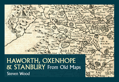
In his last two books, Haworth historian Steven Wood presented a collection of 600 old photographs of the villages of Haworth, Oxenhope and Stanbury. In this fascinating book, the first of a new series, he uses almost 100 old maps to portray further aspects of the history of the three villages. The oldest map dates from 1610 and the most recent from 1937 - a span of more than three centuries. Many different types of map are included: County maps, Ordnance Survey maps and plans, Board of Health plans, the Haworth tithe map, a Haworth village house repopulation plan, Oxenhope enclosure maps, estate and sale plans, Haworth parish church plans, Worth Walley waterworks plans, railway and road plans and building plans. Between them they and their accompanying text reveal many details of the history of the home of the Brontes and its neighbouring villages. They can also serve as a guide to the use of maps in local history studies. Central to this book is the Haworth house repopulation plan, which is published here for the first time. This very large scale plan of Haworth village shows exactly who lived where in 1851 and what they did for a living. It provides the most detailed view ever of the Haworth that the Brontes knew.
Read Less