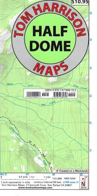
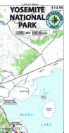
The new Half Dome Trail map in Yosemite National park covers the area between Tenaya Lake and Glacier Point road, centered on the Half Dome. Verna Fall, Nevada Fall, North Dome, Clouds Rest, Tenaya Lake, Glacier Point, Yosemite Creek, Panorama Trail, Little Yosemite Valley & Mono Meadow. Map is at a scale where one inch represents a half-mile. Printed on waterproof & tear resistant plastic.
Read More
The new Half Dome Trail map in Yosemite National park covers the area between Tenaya Lake and Glacier Point road, centered on the Half Dome. Verna Fall, Nevada Fall, North Dome, Clouds Rest, Tenaya Lake, Glacier Point, Yosemite Creek, Panorama Trail, Little Yosemite Valley & Mono Meadow. Map is at a scale where one inch represents a half-mile. Printed on waterproof & tear resistant plastic.
Read Less