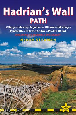
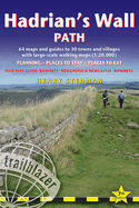
Hadrian's Wall Path, 84 miles from end to end, follows the course of northern Europe's largest surviving Roman monument, a 2nd-century fortification built - in the border country between England and Scotland - on the orders of the Emperor Hadrian in AD122. Opened in 2003, the path crosses the beautiful border country between England and Scotland. It is the first National Trail to follow the course of a UNESCO World Heritage Site. This week-long walk is regarded as one of the least challenging National Trails. 7 town plans ...
Read More
Hadrian's Wall Path, 84 miles from end to end, follows the course of northern Europe's largest surviving Roman monument, a 2nd-century fortification built - in the border country between England and Scotland - on the orders of the Emperor Hadrian in AD122. Opened in 2003, the path crosses the beautiful border country between England and Scotland. It is the first National Trail to follow the course of a UNESCO World Heritage Site. This week-long walk is regarded as one of the least challenging National Trails. 7 town plans and 59 large-scale walking maps - at just under 1:20,000 - showing route times, places to stay, points of interest and much moreItineraries for all walkers - whether walking the route in its entirety over seven to eight days or sampling the highlights on day walks and short breaksPractical information for all budgets - camping, bunkhouses, hostels, B&Bs, pubs and hotels; Newcastle through to Bowness - where to stay, where to eat, what to see, plus detailed street plansComprehensive public transport information - for all access points on the Hadrian's Wall Path.Flora and fauna - four page full color flower guide, plus an illustrated section on local wildlifeGreen hiking - understanding the local environment and minimizing our impact on itNewcastle city guideGPS waypoints. These are also downloadable from the Trailblazer website.Now includes extra colour sections: 16pp colour introduction and 16pp of colour mapping for stage sections (one stage per page) with trail profiles.
Read Less
Add this copy of Hadrian's Wall Path: Wallsend to Bowness-on-Solway to cart. $14.27, good condition, Sold by Anybook rated 5.0 out of 5 stars, ships from Lincoln, UNITED KINGDOM, published 2014 by Trailblazer Publications.
Choose your shipping method in Checkout. Costs may vary based on destination.
Seller's Description:
This is an ex-library book and may have the usual library/used-book markings inside. This book has soft covers. Clean from markings. In good all round condition. Please note the Image in this listing is a stock photo and may not match the covers of the actual item, 400grams, ISBN: 9781905864584.
Add this copy of Hadrian's Wall Path: British Walking Guide: Planning, to cart. $9.94, good condition, Sold by ThriftBooks-Reno rated 5.0 out of 5 stars, ships from Reno, NV, UNITED STATES, published 2015 by Trailblazer Publications.
Add this copy of Hadrian's Wall Path: British Walking Guide: Planning, to cart. $9.94, good condition, Sold by Seattle Goodwill rated 5.0 out of 5 stars, ships from Seattle, WA, UNITED STATES, published 2015 by Trailblazer Publications.
Choose your shipping method in Checkout. Costs may vary based on destination.
Seller's Description:
May have some shelf-wear due to normal use. Your purchase funds free job training and education in the greater Seattle area. Thank you for supporting Goodwill's nonprofit mission!
Add this copy of Hadrian's Wall Path: British Walking Guide: Planning, to cart. $37.38, good condition, Sold by Bonita rated 4.0 out of 5 stars, ships from Newport Coast, CA, UNITED STATES, published 2015 by Trailblazer Publications.
Add this copy of Hadrian's Wall Path: British Walking Guide: Planning, to cart. $61.81, new condition, Sold by Just one more Chapter, ships from Miramar, FL, UNITED STATES, published 2015 by Trailblazer Publications.