Choose your shipping method in Checkout. Costs may vary based on destination.
Seller's Description:
This is an ex-library book and may have the usual library/used-book markings inside. This book has hardback covers. In fair condition, suitable as a study copy. No dust jacket. Please note the Image in this listing is a stock photo and may not match the covers of the actual item, 850grams, ISBN: 0855461721.
Choose your shipping method in Checkout. Costs may vary based on destination.
Seller's Description:
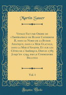
Northern Parts of Russia, for Ascertaining the Degrees of Latitude and Longitude of the Mouth of the River Kovima; of the Whole Coast of the Tshutski, to East Cape; and of the Islands in the Eastern Ocean, stretching to the American Coast. Performed, by Command of Her Imperial Majesty Catherine The Second, Empress of All the Russias, by Commodore Joseph Billings, In the Years 1785, &c. to 1794. The Whole Narrated from the Original Papers, by Martin Sauer, Secretary to the Expedition. 416pp, frontis., 14 plates & fldg. map (1802) reprinted Richmond Publishing, Richmond, Surrey 1972. Very good.
Choose your shipping method in Checkout. Costs may vary based on destination.
Seller's Description:
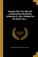
Very good. No dust jacket. Very Good hardcover, no DJ. Facsimile reprint of 1802 publication. Light blue cloth over boards, gilt titles on spine. Clean, square covers and spine; slight fading along spine edges; lightly scuffed; tightly bound; bright, clean interior. Fold-out map intact and As New; all plates present. 8vo, 390 pp (332 + 58 pp appendices).
Choose your shipping method in Checkout. Costs may vary based on destination.
Seller's Description:
Good. No dust jacket. light shelf wear, some age discoloration top edge, clean and tight copy otherwise. [4], xxvii, 332, 58, [2] p., 12 leaves (1 fold. ): ill., map; 23 cm. Blue cloth boards. Reprint of the 1802 ed. published by T. Cadell and W. Davies, London, under title: An account of a geographical and astronomical expedition to the northern parts of Russia: with new introd.
London. Printed by A. Strahan, for T. Cadell. 1802
Hardcover
Details:
Edition:
1st Edition
Publisher:
London. Printed by A. Strahan, for T. Cadell. 1802
Language:
English
Alibris ID:
16851155645
Shipping Options:
Standard Shipping: $4.66
Choose your shipping method in Checkout. Costs may vary based on destination.
Seller's Description:
4to. 26.7cm, the First Edition, xxvi, [2], 332, 58p., (appendix: vocabularies), with 14 engraved plates, large engraved folding map, contemporary boards, rebacked in calf, light damp stain through the bottom spine corner mainly on the plates, and the last 20 text pages. Lada-Mocarski 58. Sabin 77152. Street VI: 3499. Howes S117. Cox. I-353. Hill I: 268. Smith 8989. Wickersham 6134. Nerhood #112. -One of the most important Russian expeditions to Siberia and Alaska, with much material on the land and people, views of Kadiak, Aleutians, Kamchatka, etc. Captain Joseph Billings, who had sailed with James Cook on Cook's last voyage, became an officer in the Russian navy and was given command of this expedition by the Empress. He had, as his secretary, Martin Sauer, who was responsible for this, the fullest account of this important expedition. Visits were made to Kodiack, Montague Island, and Prince William Sound. Eventually a scarcity of provisions forced the return of the expedition to the mainland. The map, A Chart of the Strait between Asia and America, is by Arrowsmith. "Englishman serving in Catherine's navies sails and rides horseback along the north Russian coast, 1785-94. He provides a valuable description of the land and the natives by word and sketch". (Nerhood).