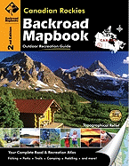
This backroad mapbook is a complete road and recreation atlas for the Canadian Rockies. It includes 39-colour recreational GPS-compatible relief maps and information on outdoor recreational opportunities available in the area. The book covers four national parks (Banff, Jasper, Kootenay, and Yoho), six provincial parks (Elk Lakes, Hamber, Height-of-the-Rockies, Mount Assiniboine, Mount Robson, and Wilmore Wilderness), and Kananaskis country and includes detailed maps of cities and towns in the area.
Read More
This backroad mapbook is a complete road and recreation atlas for the Canadian Rockies. It includes 39-colour recreational GPS-compatible relief maps and information on outdoor recreational opportunities available in the area. The book covers four national parks (Banff, Jasper, Kootenay, and Yoho), six provincial parks (Elk Lakes, Hamber, Height-of-the-Rockies, Mount Assiniboine, Mount Robson, and Wilmore Wilderness), and Kananaskis country and includes detailed maps of cities and towns in the area.
Read Less
Add this copy of Canadian Rockies to cart. $36.92, good condition, Sold by ThriftBooks-Atlanta rated 5.0 out of 5 stars, ships from Austell, GA, UNITED STATES, published 2010 by Mussio Ventures.
Add this copy of Canadian Rockies (Backroad Mapbooks) to cart. $71.59, good condition, Sold by Bonita rated 4.0 out of 5 stars, ships from Newport Coast, CA, UNITED STATES, published 2010 by Mussio Ventures.