This comprehensive atlas delves into the cartographic history of WWII: naval, land, and aerial attacks from the invasion of Poland to Pearl Harbor and the Battle of the Bulge. Rare maps include a detailed Germany & Approaches map used by Allied forces in the final stages of the war, full large-scale wartime maps of the world used by President Roosevelt, and crucial Pacific theater maps used by B-17 pilots. Satellite data renders terrain as never before seen, highlighting countries and continents in stunning detail to ...
Read More
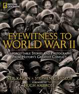
This comprehensive atlas delves into the cartographic history of WWII: naval, land, and aerial attacks from the invasion of Poland to Pearl Harbor and the Battle of the Bulge. Rare maps include a detailed Germany & Approaches map used by Allied forces in the final stages of the war, full large-scale wartime maps of the world used by President Roosevelt, and crucial Pacific theater maps used by B-17 pilots. Satellite data renders terrain as never before seen, highlighting countries and continents in stunning detail to include the towns, cities, provinces, and transportation roads for a pinpoint-accurate depiction of army movements and alliances. Gripping wartime stories from these hallowed fields of battle, along with photographs, sketches, confidential documents, and artifacts color the rest of this timeless and informative book. This definitive, lavishly illustrated book features an astonishing array of vintage and newly created maps, rare photographs, covert documents, and eyewitness accounts that illuminate the world's greatest conflict.
Read Less
Choose your shipping method in Checkout. Costs may vary based on destination.
Seller's Description:
Fair. This is a hard cover book: Used-Acceptable: All pages and the cover are intact, but shrink wrap, dust covers, or boxed set case may be missing. Pages may include limited notes, highlighting, or minor water damage but the text is readable. Item may be missing bundled media.
Choose your shipping method in Checkout. Costs may vary based on destination.
Seller's Description:
Good. Connecting readers with great books since 1972! Used textbooks may not include companion materials such as access codes, etc. May have some wear or writing/highlighting. We ship orders daily and Customer Service is our top priority!
Choose your shipping method in Checkout. Costs may vary based on destination.
Seller's Description:
Very Good. Size: 10x0x13; Very Good Condition-May show some limited signs of wear and may have a remainder mark. Pages and dust cover are intact and not marred by notes or highlighting.
Choose your shipping method in Checkout. Costs may vary based on destination.
Seller's Description:
Very good. Connecting readers with great books since 1972! Used books may not include companion materials, and may have some shelf wear or limited writing. We ship orders daily and Customer Service is our top priority!
Choose your shipping method in Checkout. Costs may vary based on destination.
Seller's Description:
Very good. Ships Within 24 Hours M-F-Satisfaction Guaranteed! Has a publisher overstock mark. Item is in Good Condition. Clean Copy With Light Amount of Wear.